
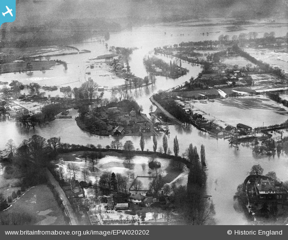
EPW020202 ENGLAND (1928). Flooding around Pharaoh's Island and Shepperton Lock, Shepperton, 1928
© Copyright OpenStreetMap contributors and licensed by the OpenStreetMap Foundation. 2026. Cartography is licensed as CC BY-SA.
Nearby Images (4)
EPW020202

EPW020202
EPW020200

EPW020200
Details
| Title | [EPW020202] Flooding around Pharaoh's Island and Shepperton Lock, Shepperton, 1928 |
| Reference | EPW020202 |
| Date | 3-January-1928 |
| Link | |
| Place name | SHEPPERTON |
| Parish | |
| District | |
| Country | ENGLAND |
| Easting / Northing | 507323, 165887 |
| Longitude / Latitude | -0.45765408534089, 51.381376305473 |
| National Grid Reference | TQ073659 |
Pins
User Comment Contributions
lock keepers house bombed ww2 |

bumblee |
Wednesday 1st of October 2014 03:05:32 PM |