
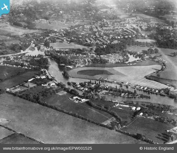
EPW001525 ENGLAND (1920). Pharaoh's Island, Hamhaugh Island and environs, Hamm Moor, 1920. This image has been produced from a copy-negative.
© Copyright OpenStreetMap contributors and licensed by the OpenStreetMap Foundation. 2025. Cartography is licensed as CC BY-SA.
Nearby Images (3)
EPW001525

EPW020200

EPW020200
Details
| Title | [EPW001525] Pharaoh's Island, Hamhaugh Island and environs, Hamm Moor, 1920. This image has been produced from a copy-negative. |
| Reference | EPW001525 |
| Date | June-1920 |
| Link | |
| Place name | HAMM MOOR |
| Parish | |
| District | |
| Country | ENGLAND |
| Easting / Northing | 507054, 165812 |
| Longitude / Latitude | -0.46154101180511, 51.380752905124 |
| National Grid Reference | TQ071658 |
Pins
Be the first to add a comment to this image!