
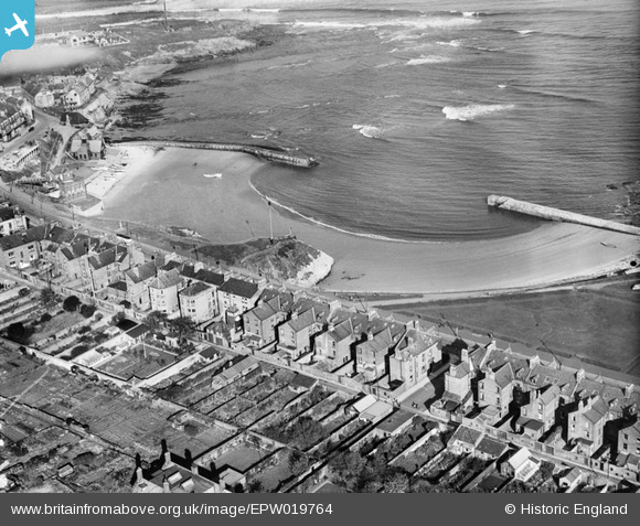
EPW019764 ENGLAND (1927). Cullercoats Bay, Cullercoats, 1927
© Copyright OpenStreetMap contributors and licensed by the OpenStreetMap Foundation. 2026. Cartography is licensed as CC BY-SA.
Nearby Images (3)
EPW019764

EPW040686

EPW040687

Details
| Title | [EPW019764] Cullercoats Bay, Cullercoats, 1927 |
| Reference | EPW019764 |
| Date | 18-October-1927 |
| Link | |
| Place name | CULLERCOATS |
| Parish | |
| District | |
| Country | ENGLAND |
| Easting / Northing | 436439, 571175 |
| Longitude / Latitude | -1.4298243631387, 55.033691211216 |
| National Grid Reference | NZ364712 |
Pins

Lonrad |
Saturday 22nd of October 2016 12:29:25 AM | |
|
Lonrad |
Saturday 22nd of October 2016 12:23:59 AM | |
 |
Lonrad |
Friday 21st of October 2016 10:10:00 AM |

Arthur Fisher |
Thursday 20th of October 2016 08:12:22 PM | |
|
Arthur Fisher |
Thursday 20th of October 2016 08:10:21 PM | |
|
cheviotwalks |
Tuesday 14th of October 2014 06:17:41 PM | |
|
cheviotwalks |
Tuesday 14th of October 2014 06:16:00 PM | |
|
cheviotwalks |
Tuesday 14th of October 2014 06:15:33 PM | |

Class31 |
Monday 21st of January 2013 11:04:39 PM |