
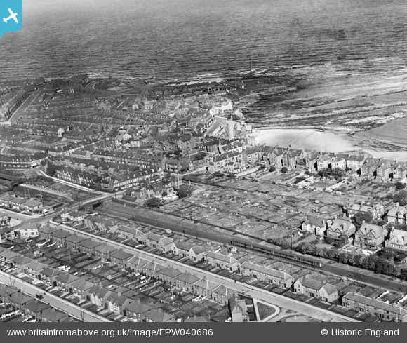
EPW040686 ENGLAND (1932). Marden Avenue and environs, Cullercoats, 1932
© Copyright OpenStreetMap contributors and licensed by the OpenStreetMap Foundation. 2026. Cartography is licensed as CC BY-SA.
Nearby Images (2)
EPW040686

EPW019764

Details
| Title | [EPW040686] Marden Avenue and environs, Cullercoats, 1932 |
| Reference | EPW040686 |
| Date | October-1932 |
| Link | |
| Place name | CULLERCOATS |
| Parish | |
| District | |
| Country | ENGLAND |
| Easting / Northing | 436283, 571222 |
| Longitude / Latitude | -1.4322592520131, 55.034124996182 |
| National Grid Reference | NZ363712 |
Pins

reaper |
Sunday 7th of December 2014 07:00:08 PM | |
|
cheviotwalks |
Tuesday 14th of October 2014 06:20:55 PM | |
|
cheviotwalks |
Tuesday 14th of October 2014 06:19:35 PM | |
|
cheviotwalks |
Tuesday 14th of October 2014 06:18:41 PM | |
|
Southlands |
Tuesday 8th of October 2013 01:01:12 PM |