
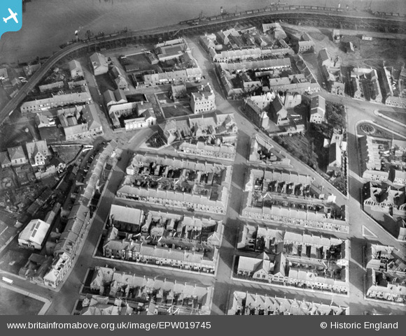
EPW019745 ENGLAND (1927). Carlton Street and environs, Blyth, 1927
© Copyright OpenStreetMap contributors and licensed by the OpenStreetMap Foundation. 2026. Cartography is licensed as CC BY-SA.
Nearby Images (6)
EPW019745

EAW013065

EAW014457

EPW019747

EPW048825

EPW048843

Details
| Title | [EPW019745] Carlton Street and environs, Blyth, 1927 |
| Reference | EPW019745 |
| Date | 18-October-1927 |
| Link | |
| Place name | BLYTH |
| Parish | BLYTH |
| District | |
| Country | ENGLAND |
| Easting / Northing | 431714, 581556 |
| Longitude / Latitude | -1.502598756147, 55.127306629976 |
| National Grid Reference | NZ317816 |
Pins

Kimblehmoose |
Thursday 24th of March 2022 01:10:32 AM | |
|
tony |
Thursday 20th of June 2013 03:32:19 PM |