
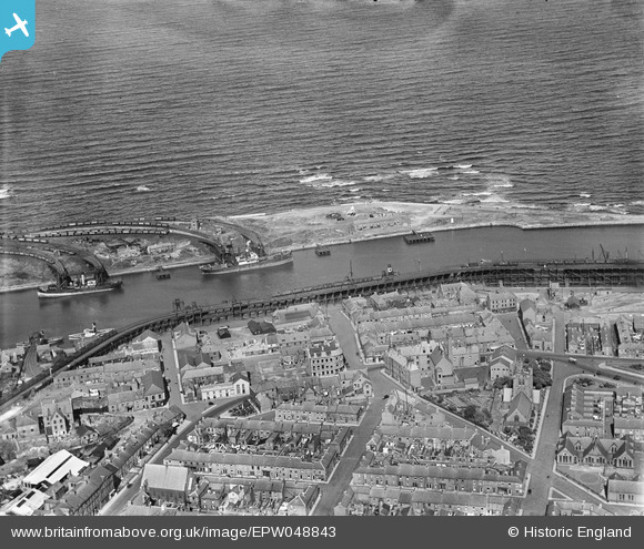
EPW048843 ENGLAND (1935). Plessey Road, the South Side Staiths, the harbour and environs, Blyth, 1935
© Copyright OpenStreetMap contributors and licensed by the OpenStreetMap Foundation. 2026. Cartography is licensed as CC BY-SA.
Nearby Images (3)
EPW048843

EAW014457

EPW019745

Details
| Title | [EPW048843] Plessey Road, the South Side Staiths, the harbour and environs, Blyth, 1935 |
| Reference | EPW048843 |
| Date | August-1935 |
| Link | |
| Place name | BLYTH |
| Parish | EAST BEDLINGTON |
| District | |
| Country | ENGLAND |
| Easting / Northing | 431935, 581755 |
| Longitude / Latitude | -1.4991103619533, 55.129080785419 |
| National Grid Reference | NZ319818 |
Pins

redmist |
Wednesday 6th of November 2019 09:15:21 PM |