
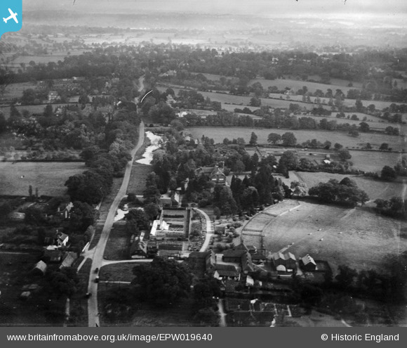
EPW019640 ENGLAND (1927). Ellern Mede Farm and Totteridge Lodge, Totteridge, from the west, 1927
© Copyright OpenStreetMap contributors and licensed by the OpenStreetMap Foundation. 2026. Cartography is licensed as CC BY-SA.
Nearby Images (7)
EPW019640

EPW019633

EPW019635

EPW019636

EPW019668

EPW019634

EPW019637

Details
| Title | [EPW019640] Ellern Mede Farm and Totteridge Lodge, Totteridge, from the west, 1927 |
| Reference | EPW019640 |
| Date | October-1927 |
| Link | |
| Place name | TOTTERIDGE |
| Parish | |
| District | |
| Country | ENGLAND |
| Easting / Northing | 523211, 194008 |
| Longitude / Latitude | -0.21961026865569, 51.630906062058 |
| National Grid Reference | TQ232940 |
Pins
Be the first to add a comment to this image!