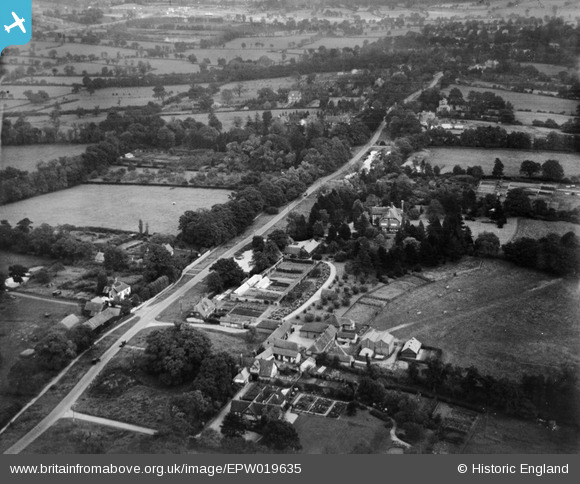
EPW019635 ENGLAND (1927). Ellern Mede Farm and Totteridge Lodge, Totteridge, 1927
© Copyright OpenStreetMap contributors and licensed by the OpenStreetMap Foundation. 2025. Cartography is licensed as CC BY-SA.
Nearby Images (9)
Details
| Title | [EPW019635] Ellern Mede Farm and Totteridge Lodge, Totteridge, 1927 |
| Reference | EPW019635 |
| Date | October-1927 |
| Link | |
| Place name | TOTTERIDGE |
| Parish | |
| District | |
| Country | ENGLAND |
| Easting / Northing | 523258, 194069 |
| Longitude / Latitude | -0.21890999691219, 51.631444030538 |
| National Grid Reference | TQ233941 |
Pins
Be the first to add a comment to this image!


![[EPW019635] Ellern Mede Farm and Totteridge Lodge, Totteridge, 1927](http://britainfromabove.org.uk/sites/all/libraries/aerofilms-images/public/100x100/EPW/019/EPW019635.jpg)
![[EPW019633] Totteridge Common, Totteridge, from the west, 1927](http://britainfromabove.org.uk/sites/all/libraries/aerofilms-images/public/100x100/EPW/019/EPW019633.jpg)
![[EPW019640] Ellern Mede Farm and Totteridge Lodge, Totteridge, from the west, 1927](http://britainfromabove.org.uk/sites/all/libraries/aerofilms-images/public/100x100/EPW/019/EPW019640.jpg)
![[EPW019668] Totteridge Lodge and environs, Totteridge, from the north-west, 1927](http://britainfromabove.org.uk/sites/all/libraries/aerofilms-images/public/100x100/EPW/019/EPW019668.jpg)
![[EPW019634] Totteridge Common, Totteridge, from the west, 1927](http://britainfromabove.org.uk/sites/all/libraries/aerofilms-images/public/100x100/EPW/019/EPW019634.jpg)
![[EPW019636] Ellern Mede Farm and Totteridge Lodge, Totteridge, 1927](http://britainfromabove.org.uk/sites/all/libraries/aerofilms-images/public/100x100/EPW/019/EPW019636.jpg)
![[EPW019637] Totteridge Park and Totteridge Common, Totteridge, from the west, 1927](http://britainfromabove.org.uk/sites/all/libraries/aerofilms-images/public/100x100/EPW/019/EPW019637.jpg)
![[EPW019631] Totteridge Common, Totteridge, from the north-west, 1927](http://britainfromabove.org.uk/sites/all/libraries/aerofilms-images/public/100x100/EPW/019/EPW019631.jpg)
![[EPW019675] Totteridge Park and Totteridge Common, Totteridge, from the north-west, 1927](http://britainfromabove.org.uk/sites/all/libraries/aerofilms-images/public/100x100/EPW/019/EPW019675.jpg)