
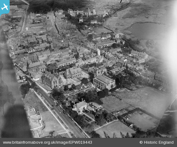
EPW019443 ENGLAND (1927). St John the Baptist Church and the town centre, Knutsford, 1927
© Copyright OpenStreetMap contributors and licensed by the OpenStreetMap Foundation. 2026. Cartography is licensed as CC BY-SA.
Nearby Images (6)
EPW019443

EAW050497

EPW019446

EPW019445

EAW050495

EPW019444

Details
| Title | [EPW019443] St John the Baptist Church and the town centre, Knutsford, 1927 |
| Reference | EPW019443 |
| Date | October-1927 |
| Link | |
| Place name | KNUTSFORD |
| Parish | KNUTSFORD |
| District | |
| Country | ENGLAND |
| Easting / Northing | 375227, 378575 |
| Longitude / Latitude | -2.3717848409072, 53.303270182357 |
| National Grid Reference | SJ752786 |
Pins

Ian Warburton |
Sunday 28th of December 2014 04:23:06 PM | |
|
Ian Warburton |
Sunday 28th of December 2014 04:21:01 PM | |
|
Ian Warburton |
Sunday 28th of December 2014 04:19:46 PM | |
|
Ian Warburton |
Sunday 28th of December 2014 04:17:23 PM | |
|
bassman |
Sunday 15th of June 2014 07:32:43 PM |