
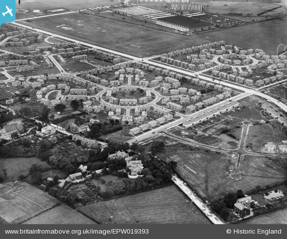
EPW019393 ENGLAND (1927). Western Circle, Burnage, 1927
© Copyright OpenStreetMap contributors and licensed by the OpenStreetMap Foundation. 2025. Cartography is licensed as CC BY-SA.
Nearby Images (12)
EPW019393

EPW019392

EPW019386

EPW019125

EPW019123

EPW019128

EPW019388

EPW019394

EPW019390

EPW019126

EPW019124

EPW019387

Details
| Title | [EPW019393] Western Circle, Burnage, 1927 |
| Reference | EPW019393 |
| Date | 30-September-1927 |
| Link | |
| Place name | BURNAGE |
| Parish | |
| District | |
| Country | ENGLAND |
| Easting / Northing | 386841, 392593 |
| Longitude / Latitude | -2.1980710943073, 53.429702404058 |
| National Grid Reference | SJ868926 |
Pins
 DreamReiver |
Saturday 3rd of September 2016 04:03:03 PM | |
John Ellis |
Monday 27th of August 2012 06:17:33 PM | |
John Ellis |
Monday 27th of August 2012 05:15:14 PM | |
John Ellis |
Monday 27th of August 2012 05:14:33 PM | |
John Ellis |
Monday 27th of August 2012 05:13:18 PM | |
John Ellis |
Monday 27th of August 2012 05:12:35 PM | |
John Ellis |
Monday 27th of August 2012 05:11:42 PM | |
John Ellis |
Monday 27th of August 2012 05:11:10 PM | |
John Ellis |
Monday 27th of August 2012 05:09:43 PM | |
John Ellis |
Monday 27th of August 2012 05:09:18 PM | |
John Ellis |
Monday 27th of August 2012 05:08:38 PM | |
John Ellis |
Monday 27th of August 2012 05:08:12 PM | |
John Ellis |
Monday 27th of August 2012 05:07:47 PM | |
John Ellis |
Monday 27th of August 2012 05:07:15 PM | |
John Ellis |
Monday 27th of August 2012 05:06:50 PM | |
John Ellis |
Monday 27th of August 2012 05:06:20 PM | |
John Ellis |
Monday 27th of August 2012 05:05:45 PM |