
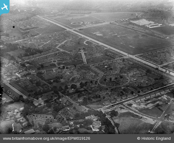
EPW019126 ENGLAND (1927). Western Circle, May Drive and environs, Burnage, 1927
© Copyright OpenStreetMap contributors and licensed by the OpenStreetMap Foundation. 2025. Cartography is licensed as CC BY-SA.
Nearby Images (13)
EPW019126

EPW019394

EPW019390

EPW019124

EPW019388

EPW019128

EPW019123

EPW019386

EPW019125

EPW019387

EPW019392

EPW019393

EPW019127

Details
| Title | [EPW019126] Western Circle, May Drive and environs, Burnage, 1927 |
| Reference | EPW019126 |
| Date | 4-August-1927 |
| Link | |
| Place name | BURNAGE |
| Parish | |
| District | |
| Country | ENGLAND |
| Easting / Northing | 386912, 392793 |
| Longitude / Latitude | -2.1970107128927, 53.431502073962 |
| National Grid Reference | SJ869928 |
Pins
 DreamReiver |
Saturday 3rd of September 2016 03:52:11 PM | |
John Ellis |
Saturday 15th of December 2012 05:10:41 PM | |
John Ellis |
Saturday 15th of December 2012 05:09:40 PM | |
John Ellis |
Saturday 15th of December 2012 05:08:50 PM | |
John Ellis |
Saturday 15th of December 2012 05:07:29 PM | |
John Ellis |
Saturday 15th of December 2012 05:06:12 PM | |
John Ellis |
Saturday 15th of December 2012 05:04:55 PM | |
John Ellis |
Saturday 15th of December 2012 05:04:19 PM | |
John Ellis |
Saturday 15th of December 2012 05:03:30 PM | |
John Ellis |
Saturday 15th of December 2012 04:54:32 PM | |
John Ellis |
Saturday 15th of December 2012 04:53:32 PM | |
John Ellis |
Saturday 15th of December 2012 04:52:40 PM | |
John Ellis |
Saturday 15th of December 2012 04:52:15 PM | |
John Ellis |
Saturday 15th of December 2012 04:50:51 PM | |
John Ellis |
Saturday 15th of December 2012 04:46:25 PM | |
John Ellis |
Saturday 15th of December 2012 04:45:55 PM | |
John Ellis |
Saturday 15th of December 2012 04:44:53 PM | |
John Ellis |
Saturday 15th of December 2012 04:43:41 PM | |
John Ellis |
Saturday 15th of December 2012 04:43:12 PM | |
John Ellis |
Saturday 15th of December 2012 04:42:37 PM | |
John Ellis |
Saturday 15th of December 2012 04:42:02 PM | |
John Ellis |
Saturday 15th of December 2012 04:41:15 PM | |
John Ellis |
Saturday 15th of December 2012 04:40:43 PM | |
John Ellis |
Saturday 15th of December 2012 04:38:56 PM | |
John Ellis |
Saturday 15th of December 2012 04:38:20 PM | |
John Ellis |
Saturday 15th of December 2012 04:37:12 PM | |
TheBlueCube |
Monday 19th of November 2012 01:25:25 AM | |
Too far west! This is the hedge which forms the boundary between Heaton Chapel (Heaton Norris township/Stockport) and Burnage/Manchester. The roofs to the right (east) are part of the Crossley Road industrial estate, on the Heaton Chapel side of the hedge. |
John Ellis |
Saturday 15th of December 2012 05:02:22 PM |