
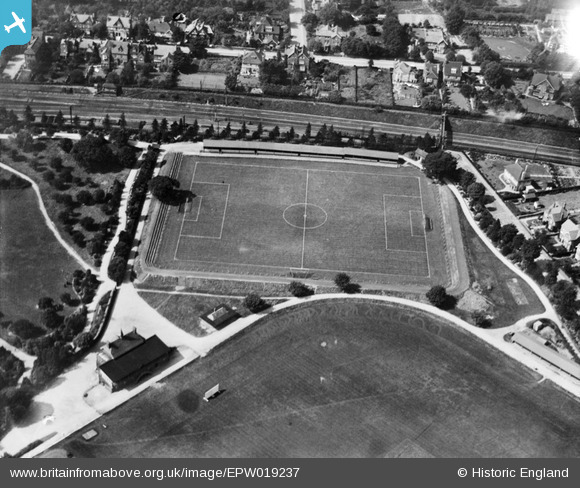
EPW019237 ENGLAND (1927). Clarence Park Football Ground and Recreation Ground, St Albans, 1927
© Copyright OpenStreetMap contributors and licensed by the OpenStreetMap Foundation. 2025. Cartography is licensed as CC BY-SA.
Nearby Images (2)
EPW019237

EPW025390

Details
| Title | [EPW019237] Clarence Park Football Ground and Recreation Ground, St Albans, 1927 |
| Reference | EPW019237 |
| Date | August-1927 |
| Link | |
| Place name | ST ALBANS |
| Parish | |
| District | |
| Country | ENGLAND |
| Easting / Northing | 515704, 207498 |
| Longitude / Latitude | -0.32355957875749, 51.753753453789 |
| National Grid Reference | TL157075 |
Pins

John W |
Sunday 12th of July 2020 05:47:27 PM |