
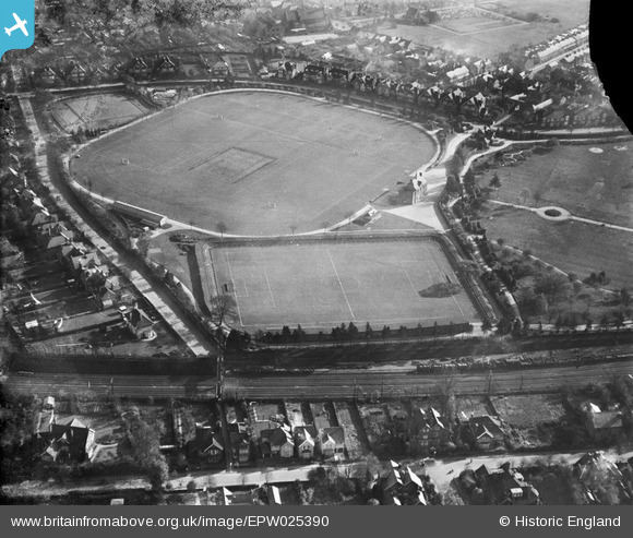
EPW025390 ENGLAND (1928). Clarence Park Football Ground and Recreation Ground, St Albans, 1928
© Copyright OpenStreetMap contributors and licensed by the OpenStreetMap Foundation. 2025. Cartography is licensed as CC BY-SA.
Nearby Images (2)
EPW025390

EPW019237

Details
| Title | [EPW025390] Clarence Park Football Ground and Recreation Ground, St Albans, 1928 |
| Reference | EPW025390 |
| Date | November-1928 |
| Link | |
| Place name | ST ALBANS |
| Parish | |
| District | |
| Country | ENGLAND |
| Easting / Northing | 515736, 207495 |
| Longitude / Latitude | -0.32309714239178, 51.753719876845 |
| National Grid Reference | TL157075 |
Pins

John W |
Sunday 12th of July 2020 05:42:08 PM | |
|
John W |
Sunday 12th of July 2020 05:40:44 PM | |
|
John W |
Friday 8th of July 2016 07:01:09 PM |