
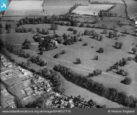
EPW017776 ENGLAND (1927). Rickmansworth Park, Rickmansworth, 1927
© Copyright OpenStreetMap contributors and licensed by the OpenStreetMap Foundation. 2026. Cartography is licensed as CC BY-SA.
Nearby Images (19)
EPW017776

EPW044251

EPW044252

EAW022715

EAW022713

EPW044253

EAW022710

EAW022717

EPW044245

EPW044249

EPW044247

EPW044248

EPW044246

EPW044250

EPW017772

EAW022712

EAW022714

EPW017773

EPW017775

Details
| Title | [EPW017776] Rickmansworth Park, Rickmansworth, 1927 |
| Reference | EPW017776 |
| Date | April-1927 |
| Link | |
| Place name | RICKMANSWORTH |
| Parish | |
| District | |
| Country | ENGLAND |
| Easting / Northing | 505727, 195311 |
| Longitude / Latitude | -0.47175425165461, 51.646177121765 |
| National Grid Reference | TQ057953 |
Pins
Be the first to add a comment to this image!