
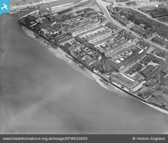
EPW016693 ENGLAND (1926). The Edward Le Bas Cyclops Iron Works and environs, Millwall, 1926
© Copyright OpenStreetMap contributors and licensed by the OpenStreetMap Foundation. 2026. Cartography is licensed as CC BY-SA.
Nearby Images (19)
EPW016693

EPW016691

EAW045672

EAW045670

EAW045671

EAW045668

EAW045667

EPW016688

EPW016692

EPW016687

EPW015768

EAW045666

EPW016690

EAW045665

EPW015764

EPW016689

EAW045664

EAW045669

EAW021719

Details
| Title | [EPW016693] The Edward Le Bas Cyclops Iron Works and environs, Millwall, 1926 |
| Reference | EPW016693 |
| Date | August-1926 |
| Link | |
| Place name | MILLWALL |
| Parish | |
| District | |
| Country | ENGLAND |
| Easting / Northing | 537114, 178815 |
| Longitude / Latitude | -0.024761947055672, 51.491148879661 |
| National Grid Reference | TQ371788 |
Pins

PeterJames |
Sunday 11th of November 2012 12:26:30 AM | |
|
PeterJames |
Sunday 11th of November 2012 12:25:20 AM |