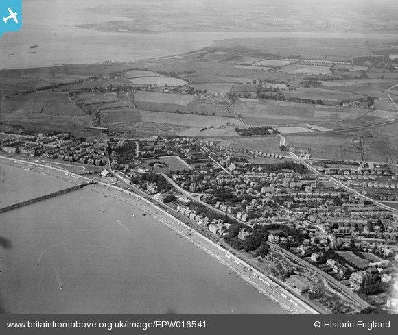
EPW016541 ENGLAND (1926). View of the west of town towards the port, Felixstowe, from the east, 1926
© Copyright OpenStreetMap contributors and licensed by the OpenStreetMap Foundation. 2026. Cartography is licensed as CC BY-SA.
Nearby Images (7)
Details
| Title | [EPW016541] View of the west of town towards the port, Felixstowe, from the east, 1926 |
| Reference | EPW016541 |
| Date | August-1926 |
| Link | |
| Place name | FELIXSTOWE |
| Parish | FELIXSTOWE |
| District | |
| Country | ENGLAND |
| Easting / Northing | 630278, 234337 |
| Longitude / Latitude | 1.3520945824849, 51.959315193894 |
| National Grid Reference | TM303343 |


![[EPW016541] View of the west of town towards the port, Felixstowe, from the east, 1926](http://britainfromabove.org.uk/sites/all/libraries/aerofilms-images/public/100x100/EPW/016/EPW016541.jpg)
![[EAW038358] Undercliff Road West, Felixstowe, 1951. This image has been produced from a print.](http://britainfromabove.org.uk/sites/all/libraries/aerofilms-images/public/100x100/EAW/038/EAW038358.jpg)
![[EAW038360] The town and seafront, Felixstowe, 1951](http://britainfromabove.org.uk/sites/all/libraries/aerofilms-images/public/100x100/EAW/038/EAW038360.jpg)
![[EPW001917] View of Felixstowe, Felixstowe, 1920](http://britainfromabove.org.uk/sites/all/libraries/aerofilms-images/public/100x100/EPW/001/EPW001917.jpg)
![[EPW039283] The Spa Pavilion, Hamilton Gardens and environs, Felixstowe, 1932](http://britainfromabove.org.uk/sites/all/libraries/aerofilms-images/public/100x100/EPW/039/EPW039283.jpg)
![[EPW039279] Felixstowe Pier, Hall, Undercliff Road West and environs, Felixstowe, 1932](http://britainfromabove.org.uk/sites/all/libraries/aerofilms-images/public/100x100/EPW/039/EPW039279.jpg)
![[EAW024310] The town, Felixstowe, from the south-east, 1949](http://britainfromabove.org.uk/sites/all/libraries/aerofilms-images/public/100x100/EAW/024/EAW024310.jpg)

