
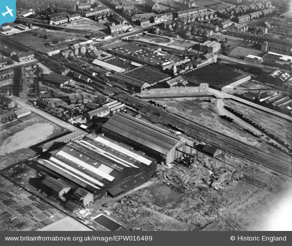
EPW016489 ENGLAND (1926). The Atlantic Engineering Works, Altrincham, 1926
© Copyright OpenStreetMap contributors and licensed by the OpenStreetMap Foundation. 2026. Cartography is licensed as CC BY-SA.
Nearby Images (3)
EPW016489

EAW031525

EAW031529

Details
| Title | [EPW016489] The Atlantic Engineering Works, Altrincham, 1926 |
| Reference | EPW016489 |
| Date | August-1926 |
| Link | |
| Place name | ALTRINCHAM |
| Parish | |
| District | |
| Country | ENGLAND |
| Easting / Northing | 376405, 389254 |
| Longitude / Latitude | -2.354902663383, 53.399322987253 |
| National Grid Reference | SJ764893 |
Pins

J May |
Tuesday 11th of March 2025 04:34:38 PM | |
|
J May |
Tuesday 11th of March 2025 04:34:00 PM | |
|
JonL |
Tuesday 23rd of April 2024 10:12:50 AM | |
 |
AltyCivicSoc |
Monday 13th of July 2020 05:18:01 PM |
|
lula74 |
Saturday 16th of July 2016 09:05:48 PM | |
|
Fire123 |
Thursday 5th of November 2015 10:32:47 AM | |
|
John Ellis |
Friday 14th of December 2012 08:14:52 PM | |
|
John Ellis |
Friday 14th of December 2012 08:13:58 PM | |
|
John Ellis |
Friday 14th of December 2012 08:12:46 PM | |
|
John Ellis |
Friday 14th of December 2012 08:11:44 PM | |
|
John Ellis |
Friday 14th of December 2012 08:10:54 PM | |
|
John Ellis |
Friday 14th of December 2012 08:10:04 PM | |
|
John Ellis |
Friday 14th of December 2012 08:05:39 PM | |
|
John Ellis |
Friday 14th of December 2012 07:57:49 PM | |
|
John Ellis |
Friday 14th of December 2012 07:52:14 PM | |
|
JH |
Saturday 15th of September 2012 12:47:06 PM | |
Sorry - "then Halford's" |
JH |
Saturday 15th of September 2012 12:48:15 PM |
|
Mike |
Thursday 30th of August 2012 08:57:04 PM | |
|
Mike |
Thursday 30th of August 2012 08:56:06 PM | |
|
Mike |
Thursday 30th of August 2012 08:55:08 PM | |
|
Mike |
Thursday 30th of August 2012 08:53:56 PM |