
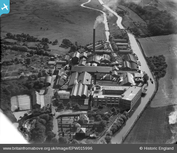
EPW015996 ENGLAND (1926). The Croxley Paper Mills, Croxley Green, 1926
© Copyright OpenStreetMap contributors and licensed by the OpenStreetMap Foundation. 2026. Cartography is licensed as CC BY-SA.
Nearby Images (21)
EPW015996

EPW039596

EPW015998

EAW048395

EPW039595

EPW039591

EAW048396

EAW048391

EPW015995

EAW048393

EAW048397

EPW019274

EPW019275

EPW039592

EPW039597

EPW039590

EPW039593

EPW039594

EAW048394

EPW015997

EAW048392

Details
| Title | [EPW015996] The Croxley Paper Mills, Croxley Green, 1926 |
| Reference | EPW015996 |
| Date | 30-June-1926 |
| Link | |
| Place name | CROXLEY GREEN |
| Parish | CROXLEY GREEN |
| District | |
| Country | ENGLAND |
| Easting / Northing | 508436, 195369 |
| Longitude / Latitude | -0.43259423564054, 51.646182484307 |
| National Grid Reference | TQ084954 |
Pins

The Laird |
Tuesday 3rd of October 2017 04:26:30 PM |