
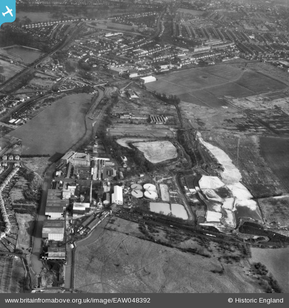
EAW048392 ENGLAND (1953). Croxley Paper Mills and environs, Croxley Green, 1953
© Copyright OpenStreetMap contributors and licensed by the OpenStreetMap Foundation. 2026. Cartography is licensed as CC BY-SA.
Nearby Images (15)
EAW048392

EPW015995

EPW019274

EAW048395

EPW039591

EPW015998

EPW039595

EPW039596

EAW048397

EPW015996

EPW015997

EPW019275

EAW048391

EAW048393

EAW048394

Details
| Title | [EAW048392] Croxley Paper Mills and environs, Croxley Green, 1953 |
| Reference | EAW048392 |
| Date | 5-February-1953 |
| Link | |
| Place name | CROXLEY GREEN |
| Parish | CROXLEY GREEN |
| District | |
| Country | ENGLAND |
| Easting / Northing | 508656, 195416 |
| Longitude / Latitude | -0.42940089389074, 51.64656248496 |
| National Grid Reference | TQ087954 |
