
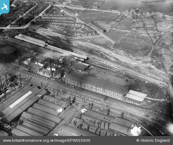
EPW015600 ENGLAND (1926). The Grimesthorpe Gas Works, Sheffield, 1926
© Copyright OpenStreetMap contributors and licensed by the OpenStreetMap Foundation. 2026. Cartography is licensed as CC BY-SA.
Nearby Images (11)
EPW015600

EPW015599

EPW015601

EPW015485

EPW015490

EAW026017

EPW015487

EPW007796

EAW022029

EAW026018

EAW026016

Details
| Title | [EPW015600] The Grimesthorpe Gas Works, Sheffield, 1926 |
| Reference | EPW015600 |
| Date | 4-May-1926 |
| Link | |
| Place name | SHEFFIELD |
| Parish | |
| District | |
| Country | ENGLAND |
| Easting / Northing | 438091, 390333 |
| Longitude / Latitude | -1.4269360545264, 53.408175227709 |
| National Grid Reference | SK381903 |
Pins

circloy |
Thursday 12th of September 2013 11:28:44 PM | |

Class31 |
Friday 26th of October 2012 04:21:24 PM | |
|
Class31 |
Friday 26th of October 2012 04:21:09 PM | |
|
Class31 |
Friday 26th of October 2012 04:20:46 PM | |
|
Class31 |
Friday 26th of October 2012 04:20:30 PM | |
|
Class31 |
Friday 26th of October 2012 04:20:13 PM | |
|
Class31 |
Friday 26th of October 2012 04:19:42 PM | |
|
Class31 |
Friday 26th of October 2012 04:19:23 PM |