
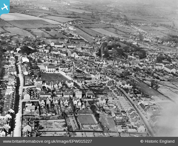
EPW015227 ENGLAND (1926). The town, Cannock, 1926. This image has been produced from a copy-negative.
© Copyright OpenStreetMap contributors and licensed by the OpenStreetMap Foundation. 2026. Cartography is licensed as CC BY-SA.
Nearby Images (5)
EPW015227

EPW034059

EPW015228

EPW034057

EPW015226

Details
| Title | [EPW015227] The town, Cannock, 1926. This image has been produced from a copy-negative. |
| Reference | EPW015227 |
| Date | 13-April-1926 |
| Link | |
| Place name | CANNOCK |
| Parish | |
| District | |
| Country | ENGLAND |
| Easting / Northing | 397987, 310063 |
| Longitude / Latitude | -2.0297839303415, 52.687907564271 |
| National Grid Reference | SJ980101 |
Pins

SteveB09 |
Friday 21st of April 2023 03:26:34 PM | |
|
SteveB09 |
Friday 21st of April 2023 12:56:55 PM | |
|
SteveB09 |
Friday 21st of April 2023 12:54:47 PM | |
|
SteveB09 |
Friday 21st of April 2023 12:33:59 PM | |
|
SteveB09 |
Friday 21st of April 2023 12:31:59 PM | |
|
Tim |
Friday 3rd of January 2020 12:22:23 PM | |
|
Paul |
Friday 27th of September 2019 03:37:57 PM | |
|
Paul |
Friday 27th of September 2019 03:37:36 PM |


