
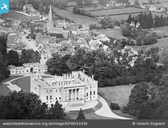
EPW014436 ENGLAND (1925). Kimbolton Castle and the village, Kimbolton, 1925. This image has been produced from a copy-negative.
© Copyright OpenStreetMap contributors and licensed by the OpenStreetMap Foundation. 2025. Cartography is licensed as CC BY-SA.
Nearby Images (7)
EPW014436

EAW023291

EAW023290

EAW023289

EAW023288

EPW014435

EPW014437

Details
| Title | [EPW014436] Kimbolton Castle and the village, Kimbolton, 1925. This image has been produced from a copy-negative. |
| Reference | EPW014436 |
| Date | 9-October-1925 |
| Link | |
| Place name | KIMBOLTON |
| Parish | KIMBOLTON |
| District | |
| Country | ENGLAND |
| Easting / Northing | 510060, 267726 |
| Longitude / Latitude | -0.38592487856393, 52.296230802822 |
| National Grid Reference | TL101677 |
Pins
Be the first to add a comment to this image!