
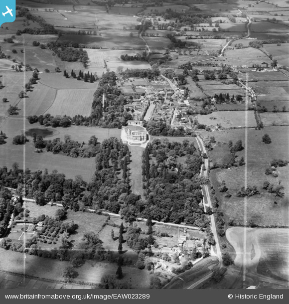
EAW023289 ENGLAND (1949). Kimbolton Castle, Park and village, Kimbolton, 1949. This image was marked by Aerofilms Ltd for photo editing.
© Copyright OpenStreetMap contributors and licensed by the OpenStreetMap Foundation. 2025. Cartography is licensed as CC BY-SA.
Nearby Images (7)
EAW023289

EAW023288

EAW023291

EAW023290

EPW014436

EPW014437

EPW014435

Details
| Title | [EAW023289] Kimbolton Castle, Park and village, Kimbolton, 1949. This image was marked by Aerofilms Ltd for photo editing. |
| Reference | EAW023289 |
| Date | 25-May-1949 |
| Link | |
| Place name | KIMBOLTON |
| Parish | KIMBOLTON |
| District | |
| Country | ENGLAND |
| Easting / Northing | 510132, 267600 |
| Longitude / Latitude | -0.38491062794287, 52.295083919259 |
| National Grid Reference | TL101676 |
Pins
User Comment Contributions
For more details on Kimbolton Castle and School, see www.kimbolton.cambs.sch.uk/page/?title=Kimbolton+Castle&pid=2. |

melgibbs |
Saturday 15th of February 2014 04:24:23 PM |