
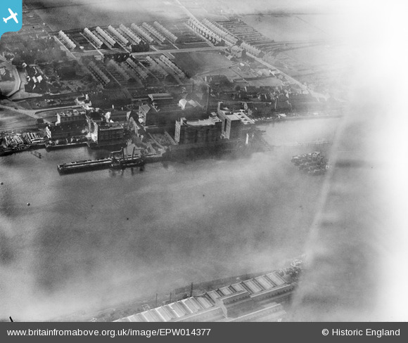
EPW014377 ENGLAND (1925). The Co-operative Flour Mills and Soap Works, Dunston, 1925
© Copyright OpenStreetMap contributors and licensed by the OpenStreetMap Foundation. 2026. Cartography is licensed as CC BY-SA.
Nearby Images (8)
EPW014377

EAW010683

EAW010684

EAW010693

EAW010707

EAW010708

EAW010692

EAW010694

Details
| Title | [EPW014377] The Co-operative Flour Mills and Soap Works, Dunston, 1925 |
| Reference | EPW014377 |
| Date | September-1925 |
| Link | |
| Place name | DUNSTON |
| Parish | |
| District | |
| Country | ENGLAND |
| Easting / Northing | 422934, 562746 |
| Longitude / Latitude | -1.6418119223635, 54.958745763108 |
| National Grid Reference | NZ229627 |
Pins
Be the first to add a comment to this image!