
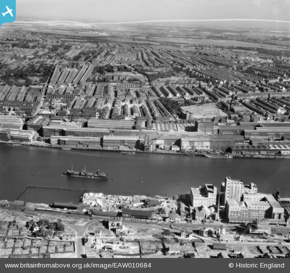
EAW010684 ENGLAND (1947). Dunston Saw Mills, the Co-operative Society Wholesale Flour Mill, the Vickers-Armstrongs Ltd Elswick Works and environs, Dunston, from the south, 1947. This image was marked by Aerofilms Ltd for photo editing.
© Copyright OpenStreetMap contributors and licensed by the OpenStreetMap Foundation. 2026. Cartography is licensed as CC BY-SA.
Nearby Images (7)
EAW010684

EPW014377

EAW010685

EAW010694

EAW010683

EAW010693

EAW010707

Details
| Title | [EAW010684] Dunston Saw Mills, the Co-operative Society Wholesale Flour Mill, the Vickers-Armstrongs Ltd Elswick Works and environs, Dunston, from the south, 1947. This image was marked by Aerofilms Ltd for photo editing. |
| Reference | EAW010684 |
| Date | 10-September-1947 |
| Link | |
| Place name | DUNSTON |
| Parish | |
| District | |
| Country | ENGLAND |
| Easting / Northing | 422760, 562778 |
| Longitude / Latitude | -1.6445268941107, 54.959041324198 |
| National Grid Reference | NZ228628 |
