
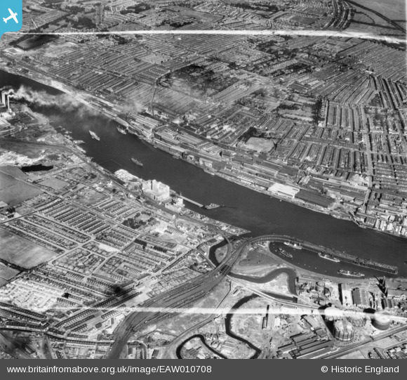
EAW010708 ENGLAND (1947). Dunston Staiths, the River Tyne, the Vickers-Armstrongs Ltd Elswick Works and environs, Elswick, 1947. This image was marked by Aerofilms Ltd for photo editing.
© Copyright OpenStreetMap contributors and licensed by the OpenStreetMap Foundation. 2026. Cartography is licensed as CC BY-SA.
Nearby Images (8)
EAW010708

EAW010707

EAW010693

EAW010692

EAW010703

EPW014377

EAW010683

EAW010689

Details
| Title | [EAW010708] Dunston Staiths, the River Tyne, the Vickers-Armstrongs Ltd Elswick Works and environs, Elswick, 1947. This image was marked by Aerofilms Ltd for photo editing. |
| Reference | EAW010708 |
| Date | 10-September-1947 |
| Link | |
| Place name | ELSWICK |
| Parish | |
| District | |
| Country | ENGLAND |
| Easting / Northing | 423025, 562931 |
| Longitude / Latitude | -1.6403758479337, 54.960404182649 |
| National Grid Reference | NZ230629 |
Pins

redmist |
Tuesday 20th of October 2020 11:47:05 AM | |
|
redmist |
Tuesday 20th of October 2020 11:46:41 AM | |
|
redmist |
Tuesday 20th of October 2020 11:46:18 AM | |
|
redmist |
Tuesday 20th of October 2020 11:45:55 AM | |
|
redmist |
Saturday 16th of November 2019 11:08:42 PM | |
|
redmist |
Saturday 16th of November 2019 11:08:02 PM | |
|
redmist |
Saturday 16th of November 2019 11:07:29 PM |