
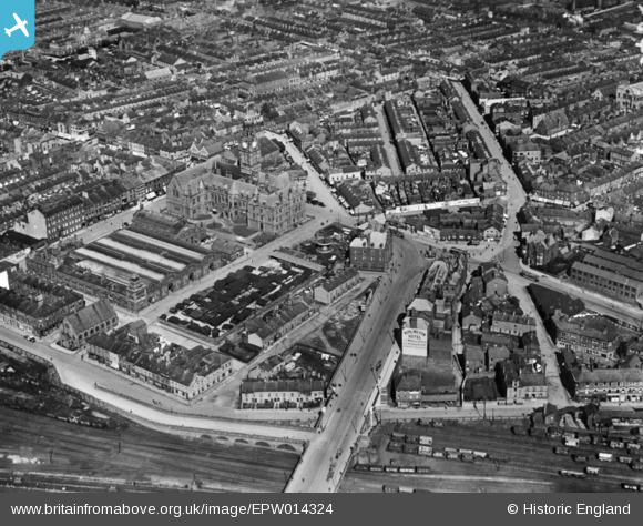
EPW014324 ENGLAND (1925). The town centre, Barrow-In-Furness, 1925. This image has been produced from a copy-negative.
© Copyright OpenStreetMap contributors and licensed by the OpenStreetMap Foundation. 2026. Cartography is licensed as CC BY-SA.
Nearby Images (5)
EPW014324

EPW004069

EPW004063

EPW004067

EPW004062

Details
| Title | [EPW014324] The town centre, Barrow-In-Furness, 1925. This image has been produced from a copy-negative. |
| Reference | EPW014324 |
| Date | 24-September-1925 |
| Link | |
| Place name | BARROW-IN-FURNESS |
| Parish | |
| District | |
| Country | ENGLAND |
| Easting / Northing | 319864, 469043 |
| Longitude / Latitude | -3.2259316244371, 54.110836050813 |
| National Grid Reference | SD199690 |
Pins

redmist |
Wednesday 9th of December 2020 04:53:55 PM | |
|
gnombicards |
Tuesday 12th of May 2020 12:41:16 PM | |
|
gnombicards |
Tuesday 12th of May 2020 12:39:59 PM | |
|
ALLEN |
Thursday 8th of August 2019 11:19:24 PM | |
|
willi |
Friday 28th of November 2014 11:25:26 PM |