
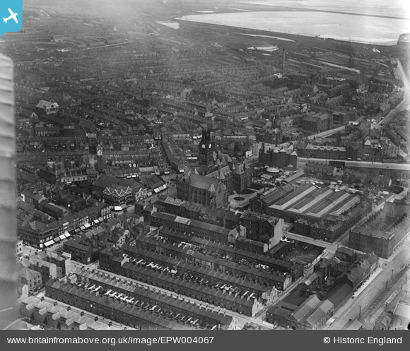
EPW004067 ENGLAND (1920). The Town Hall, Barrow-in-Furness, 1920
© Copyright OpenStreetMap contributors and licensed by the OpenStreetMap Foundation. 2026. Cartography is licensed as CC BY-SA.
Nearby Images (5)
EPW004067

EPW004063

EPW004069

EPW014324

EPW004062

Details
| Title | [EPW004067] The Town Hall, Barrow-in-Furness, 1920 |
| Reference | EPW004067 |
| Date | July-1920 |
| Link | |
| Place name | BARROW-IN-FURNESS |
| Parish | |
| District | |
| Country | ENGLAND |
| Easting / Northing | 319823, 469114 |
| Longitude / Latitude | -3.2265775256262, 54.111467701615 |
| National Grid Reference | SD198691 |
Pins

Robert - Cumbria |
Saturday 15th of March 2014 07:49:29 AM | |
|
Robert - Cumbria |
Saturday 15th of March 2014 07:47:24 AM | |
|
Robert - Cumbria |
Saturday 15th of March 2014 07:39:26 AM | |
|
Robert - Cumbria |
Friday 14th of March 2014 03:16:14 PM | |
|
Robert - Cumbria |
Friday 14th of March 2014 03:14:46 PM | |
|
Triggy |
Friday 24th of January 2014 01:24:32 PM | |
|
willi |
Saturday 7th of July 2012 11:01:40 PM | |
|
willi |
Saturday 7th of July 2012 11:00:58 PM | |
|
willi |
Saturday 7th of July 2012 10:58:34 PM |