
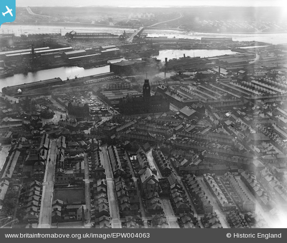
EPW004063 ENGLAND (1920). The Town Hall, Barrow-in-Furness, 1920
© Copyright OpenStreetMap contributors and licensed by the OpenStreetMap Foundation. 2026. Cartography is licensed as CC BY-SA.
Nearby Images (5)
EPW004063

EPW004067

EPW004069

EPW014324

EPW004062

Details
| Title | [EPW004063] The Town Hall, Barrow-in-Furness, 1920 |
| Reference | EPW004063 |
| Date | July-1920 |
| Link | |
| Place name | BARROW-IN-FURNESS |
| Parish | |
| District | |
| Country | ENGLAND |
| Easting / Northing | 319842, 469110 |
| Longitude / Latitude | -3.2262858691596, 54.111434717112 |
| National Grid Reference | SD198691 |
Pins

ALLEN |
Tuesday 18th of June 2019 07:38:54 PM | |
|
ALLEN |
Friday 27th of April 2018 10:50:21 AM | |
|
ALLEN |
Friday 27th of April 2018 10:48:33 AM | |
|
Laird |
Monday 16th of July 2012 05:18:58 PM | |
|
Laird |
Monday 16th of July 2012 05:18:18 PM | |
|
willi |
Saturday 7th of July 2012 10:51:45 PM | |
|
willi |
Saturday 7th of July 2012 10:47:37 PM | |
|
willi |
Saturday 7th of July 2012 10:45:05 PM | |
|
willi |
Saturday 7th of July 2012 10:44:23 PM | |
|
willi |
Saturday 7th of July 2012 10:43:36 PM |