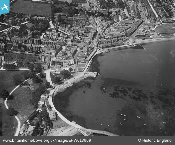
EPW013669 ENGLAND (1925). The sea front and town centre, Swanage, 1925
    © Copyright OpenStreetMap contributors and licensed by the OpenStreetMap Foundation. 2025. Cartography is licensed as CC BY-SA.
  
Nearby Images (5)
Details
| Title | [EPW013669] The sea front and town centre, Swanage, 1925 | 
| Reference | EPW013669 | 
| Date | July-1925 | 
| Link | |
| Place name | SWANAGE | 
| Parish | SWANAGE | 
| District | |
| Country | ENGLAND | 
| Easting / Northing | 403319, 78711 | 
| Longitude / Latitude | -1.9530904250364, 50.607519334109 | 
| National Grid Reference | SZ033787 | 
Pins
User Comment Contributions
|   Swanage Station | Class31 | Saturday 6th of July 2013 08:53:37 PM | 
 
             
  ![[EPW013669] The sea front and town centre, Swanage, 1925](http://britainfromabove.org.uk/sites/all/libraries/aerofilms-images/public/100x100/EPW/013/EPW013669.jpg) 
  
                                          ![[EPW013667] The Parade, Swanage, 1925](http://britainfromabove.org.uk/sites/all/libraries/aerofilms-images/public/100x100/EPW/013/EPW013667.jpg) 
 ![[EPW013664] The town centre, Swanage, 1925](http://britainfromabove.org.uk/sites/all/libraries/aerofilms-images/public/100x100/EPW/013/EPW013664.jpg) 
 ![[EPW013668] Beymer Road and surroundings, Swanage, 1925](http://britainfromabove.org.uk/sites/all/libraries/aerofilms-images/public/100x100/EPW/013/EPW013668.jpg) 
 ![[EAW030873] The town, Swanage, 1950](http://britainfromabove.org.uk/sites/all/libraries/aerofilms-images/public/100x100/EAW/030/EAW030873.jpg) 
 
 Institute Road
 Institute Road