
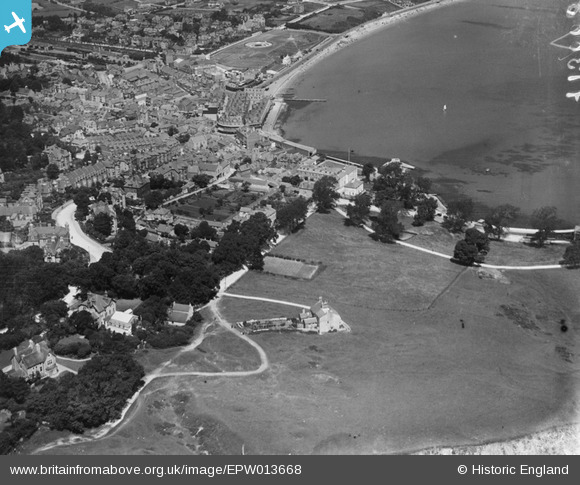
EPW013668 ENGLAND (1925). Beymer Road and surroundings, Swanage, 1925
© Copyright OpenStreetMap contributors and licensed by the OpenStreetMap Foundation. 2026. Cartography is licensed as CC BY-SA.
Nearby Images (4)
EPW013668

EPW013669

EPW013664

EPW013667

Details
| Title | [EPW013668] Beymer Road and surroundings, Swanage, 1925 |
| Reference | EPW013668 |
| Date | June-1925 |
| Link | |
| Place name | SWANAGE |
| Parish | SWANAGE |
| District | |
| Country | ENGLAND |
| Easting / Northing | 403370, 78540 |
| Longitude / Latitude | -1.9523711619293, 50.605981087984 |
| National Grid Reference | SZ034785 |
Pins

Ken |
Thursday 31st of March 2022 11:56:45 AM | |
|
Ken |
Thursday 31st of March 2022 11:54:49 AM | |
|
Ken |
Thursday 31st of March 2022 11:52:43 AM | |
|
Ken |
Thursday 31st of March 2022 11:49:11 AM | |
|
John W |
Thursday 12th of May 2016 04:29:07 PM | |
|
John W |
Thursday 12th of May 2016 04:28:31 PM | |
|
John W |
Thursday 12th of May 2016 04:17:46 PM | |

Class31 |
Saturday 6th of July 2013 09:14:48 PM |

