
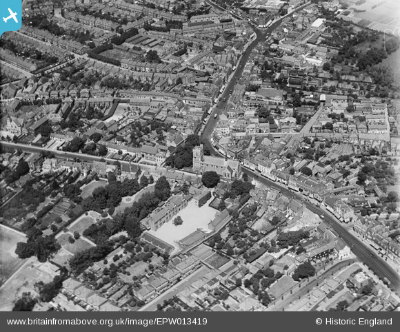
EPW013419 ENGLAND (1925). St John the Baptist's Church, Barnet, 1925
© Copyright OpenStreetMap contributors and licensed by the OpenStreetMap Foundation. 2026. Cartography is licensed as CC BY-SA.
Nearby Images (8)
EPW013419

EAW013299

EPW001548

EPW001544

EAW013298

EAW053311

EPW061333

EPW013420

Details
| Title | [EPW013419] St John the Baptist's Church, Barnet, 1925 |
| Reference | EPW013419 |
| Date | June-1925 |
| Link | |
| Place name | BARNET |
| Parish | |
| District | |
| Country | ENGLAND |
| Easting / Northing | 524537, 196455 |
| Longitude / Latitude | -0.1995887193341, 51.652607317005 |
| National Grid Reference | TQ245965 |
Pins

David |
Thursday 7th of February 2019 08:20:53 PM | |
|
rachpid |
Monday 13th of November 2017 10:15:03 AM | |
|
John Wass |
Saturday 16th of April 2016 02:32:19 PM | |
|
Lin |
Tuesday 11th of December 2012 06:25:41 PM | |
|
GWRMAD |
Wednesday 27th of June 2012 11:57:03 AM | |
|
GWRMAD |
Wednesday 27th of June 2012 11:54:50 AM | |
|
GWRMAD |
Wednesday 27th of June 2012 11:53:07 AM | |
|
GWRMAD |
Wednesday 27th of June 2012 11:52:09 AM | |
|
GWRMAD |
Wednesday 27th of June 2012 11:49:51 AM |