
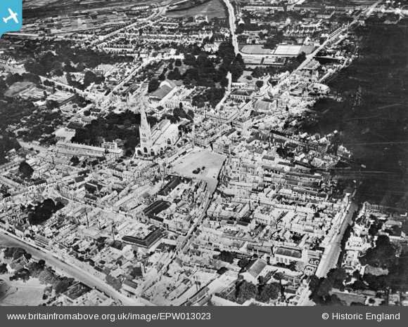
EPW013023 ENGLAND (1925). The town centre, Newark-on-Trent, 1925. This image has been produced from a damaged copy-negative.
© Copyright OpenStreetMap contributors and licensed by the OpenStreetMap Foundation. 2026. Cartography is licensed as CC BY-SA.
Nearby Images (14)
EPW013023

EAW013674

EPW015269

EPW015270

EPW042802

EAW013675

EAW006302

EAW006301

EPW042803

EAW016510

EPW016193

EAW013672

EAW013673

EAW006308

Details
| Title | [EPW013023] The town centre, Newark-on-Trent, 1925. This image has been produced from a damaged copy-negative. |
| Reference | EPW013023 |
| Date | June-1925 |
| Link | |
| Place name | NEWARK-ON-TRENT |
| Parish | NEWARK |
| District | |
| Country | ENGLAND |
| Easting / Northing | 479913, 353876 |
| Longitude / Latitude | -0.80700051377695, 53.075827681908 |
| National Grid Reference | SK799539 |
Pins
Be the first to add a comment to this image!