
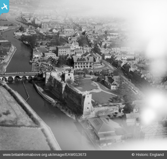
EAW013673 ENGLAND (1948). The castle, Newark-on-Trent, 1948. This image has been affected by flare.
© Copyright OpenStreetMap contributors and licensed by the OpenStreetMap Foundation. 2026. Cartography is licensed as CC BY-SA.
Nearby Images (24)
EAW013673

EAW006308

EAW016512

EAW006307

EAW016510

EPW015267

EAW006303

EAW013672

EAW006304

EPW013025

EPW016193

EPW015268

EAW016508

EAW006306

EAW016511

EAW006301

EAW016509

EAW013675

EAW006302

EPW015269

EPW015270

EPW042802

EAW013674

EPW013023

Details
| Title | [EAW013673] The castle, Newark-on-Trent, 1948. This image has been affected by flare. |
| Reference | EAW013673 |
| Date | 10-March-1948 |
| Link | |
| Place name | NEWARK-ON-TRENT |
| Parish | NEWARK |
| District | |
| Country | ENGLAND |
| Easting / Northing | 479694, 354075 |
| Longitude / Latitude | -0.81021982007003, 53.077649051123 |
| National Grid Reference | SK797541 |
Pins

MB |
Thursday 28th of November 2013 06:16:50 PM | |
|
MB |
Thursday 28th of November 2013 06:15:33 PM | |
|
MB |
Thursday 28th of November 2013 06:14:44 PM | |
|
MB |
Thursday 28th of November 2013 06:12:15 PM |