
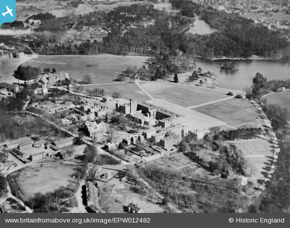
EPW012482 ENGLAND (1925). The Royal Military Academy, Sandhurst, 1925. This image has been produced from a copy-negative.
© Copyright OpenStreetMap contributors and licensed by the OpenStreetMap Foundation. 2025. Cartography is licensed as CC BY-SA.
Nearby Images (7)
EPW012482

EPW012480

EAW026307

EAW026304

EAW026306

EAW026305

EAW052000

Details
| Title | [EPW012482] The Royal Military Academy, Sandhurst, 1925. This image has been produced from a copy-negative. |
| Reference | EPW012482 |
| Date | 14-April-1925 |
| Link | |
| Place name | SANDHURST |
| Parish | SANDHURST |
| District | |
| Country | ENGLAND |
| Easting / Northing | 485879, 160884 |
| Longitude / Latitude | -0.76694941491839, 51.340046690149 |
| National Grid Reference | SU859609 |
Pins
Be the first to add a comment to this image!