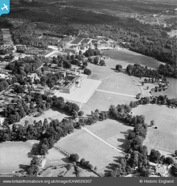
EAW026307 ENGLAND (1949). The Royal Military Academy, Sandhurst, 1949
© Copyright OpenStreetMap contributors and licensed by the OpenStreetMap Foundation. 2025. Cartography is licensed as CC BY-SA.
Nearby Images (7)
Details
| Title | [EAW026307] The Royal Military Academy, Sandhurst, 1949 |
| Reference | EAW026307 |
| Date | 6-September-1949 |
| Link | |
| Place name | SANDHURST |
| Parish | SANDHURST |
| District | |
| Country | ENGLAND |
| Easting / Northing | 485902, 160819 |
| Longitude / Latitude | -0.76663494904763, 51.339458820733 |
| National Grid Reference | SU859608 |
Pins
Be the first to add a comment to this image!


![[EAW026307] The Royal Military Academy, Sandhurst, 1949](http://britainfromabove.org.uk/sites/all/libraries/aerofilms-images/public/100x100/EAW/026/EAW026307.jpg)
![[EAW026304] The Royal Military Academy, Sandhurst, 1949](http://britainfromabove.org.uk/sites/all/libraries/aerofilms-images/public/100x100/EAW/026/EAW026304.jpg)
![[EPW012480] The Royal Miitary Academy, Sandhurst, 1925. This image has been produced from a print.](http://britainfromabove.org.uk/sites/all/libraries/aerofilms-images/public/100x100/EPW/012/EPW012480.jpg)
![[EPW012482] The Royal Military Academy, Sandhurst, 1925. This image has been produced from a copy-negative.](http://britainfromabove.org.uk/sites/all/libraries/aerofilms-images/public/100x100/EPW/012/EPW012482.jpg)
![[EAW026306] The Royal Military Academy, Sandhurst, 1949](http://britainfromabove.org.uk/sites/all/libraries/aerofilms-images/public/100x100/EAW/026/EAW026306.jpg)
![[EAW026305] The Royal Military Academy, Sandhurst, 1949](http://britainfromabove.org.uk/sites/all/libraries/aerofilms-images/public/100x100/EAW/026/EAW026305.jpg)
![[EAW052000] Royal Military Academy, Sandhurst, from the south-east, 1953](http://britainfromabove.org.uk/sites/all/libraries/aerofilms-images/public/100x100/EAW/052/EAW052000.jpg)