
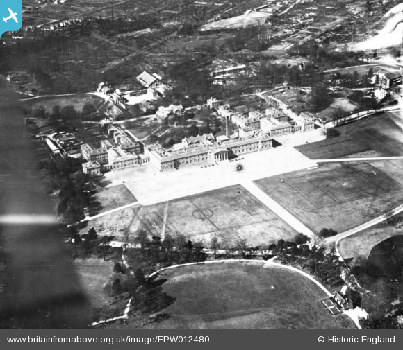
EPW012480 ENGLAND (1925). The Royal Miitary Academy, Sandhurst, 1925. This image has been produced from a print.
© Copyright OpenStreetMap contributors and licensed by the OpenStreetMap Foundation. 2025. Cartography is licensed as CC BY-SA.
Nearby Images (7)
EPW012480

EAW026307

EPW012482

EAW026304

EAW026305

EAW026306

EAW052000

Details
| Title | [EPW012480] The Royal Miitary Academy, Sandhurst, 1925. This image has been produced from a print. |
| Reference | EPW012480 |
| Date | 14-April-1925 |
| Link | |
| Place name | SANDHURST |
| Parish | SANDHURST |
| District | |
| Country | ENGLAND |
| Easting / Northing | 485849, 160837 |
| Longitude / Latitude | -0.76739138304067, 51.339628661171 |
| National Grid Reference | SU858608 |
Pins
Be the first to add a comment to this image!