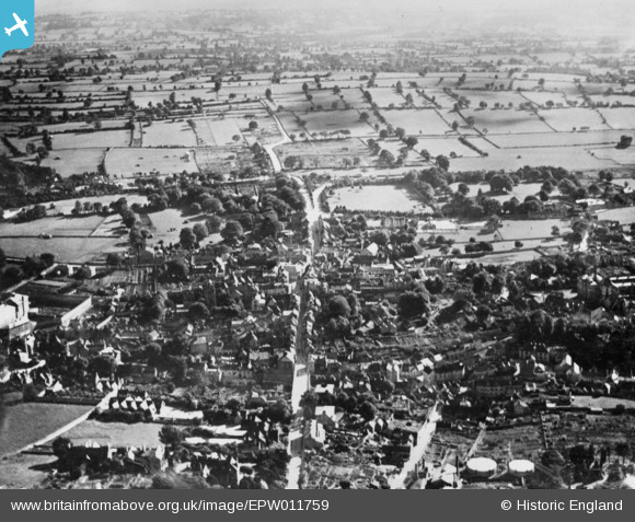
EPW011759 ENGLAND (1924). The town, Shepton Mallet, from the north, 1924. This image has been produced from a copy-negative.
© Copyright OpenStreetMap contributors and licensed by the OpenStreetMap Foundation. 2025. Cartography is licensed as CC BY-SA.
Details
| Title | [EPW011759] The town, Shepton Mallet, from the north, 1924. This image has been produced from a copy-negative. |
| Reference | EPW011759 |
| Date | 8-September-1924 |
| Link | |
| Place name | SHEPTON MALLET |
| Parish | SHEPTON MALLET |
| District | |
| Country | ENGLAND |
| Easting / Northing | 361917, 143819 |
| Longitude / Latitude | -2.5450319459191, 51.1918037064 |
| National Grid Reference | ST619438 |
Pins
 MB |
Sunday 28th of August 2016 03:06:56 PM | |
 MB |
Sunday 28th of August 2016 03:06:31 PM | |
 MB |
Sunday 28th of August 2016 03:05:55 PM | |
 MB |
Sunday 28th of August 2016 03:04:13 PM | |
 MB |
Sunday 28th of August 2016 03:03:19 PM | |
 MB |
Sunday 28th of August 2016 03:02:35 PM |


![[EPW011759] The town, Shepton Mallet, from the north, 1924. This image has been produced from a copy-negative.](http://britainfromabove.org.uk/sites/all/libraries/aerofilms-images/public/100x100/EPW/011/EPW011759.jpg)
![[EPW009588] The town centre, Shepton Mallet, 1923](http://britainfromabove.org.uk/sites/all/libraries/aerofilms-images/public/100x100/EPW/009/EPW009588.jpg)
![[EPW011758] The town centre, Shepton Mallet, 1924. This image has been produced from a copy-negative.](http://britainfromabove.org.uk/sites/all/libraries/aerofilms-images/public/100x100/EPW/011/EPW011758.jpg)
![[EPW009589] The town centre, Shepton Mallet, 1923](http://britainfromabove.org.uk/sites/all/libraries/aerofilms-images/public/100x100/EPW/009/EPW009589.jpg)