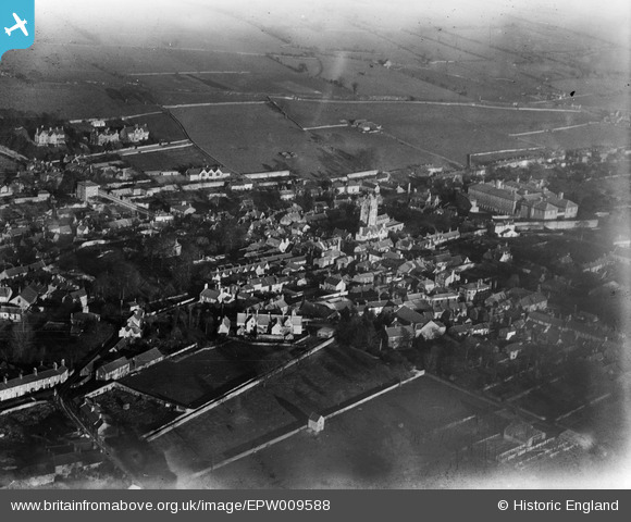
EPW009588 ENGLAND (1923). The town centre, Shepton Mallet, 1923
© Copyright OpenStreetMap contributors and licensed by the OpenStreetMap Foundation. 2025. Cartography is licensed as CC BY-SA.
Details
| Title | [EPW009588] The town centre, Shepton Mallet, 1923 |
| Reference | EPW009588 |
| Date | 1923 |
| Link | |
| Place name | SHEPTON MALLET |
| Parish | SHEPTON MALLET |
| District | |
| Country | ENGLAND |
| Easting / Northing | 361890, 143671 |
| Longitude / Latitude | -2.5454026314234, 51.190471004912 |
| National Grid Reference | ST619437 |
Pins
User Comment Contributions
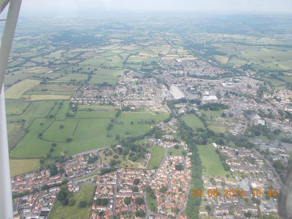
 Shepton Mallet from the air, 29/06/2014 courtesy Con Shields |
 Class31 |
Monday 21st of July 2014 04:43:23 PM |


![[EPW009588] The town centre, Shepton Mallet, 1923](http://britainfromabove.org.uk/sites/all/libraries/aerofilms-images/public/100x100/EPW/009/EPW009588.jpg)
![[EPW009589] The town centre, Shepton Mallet, 1923](http://britainfromabove.org.uk/sites/all/libraries/aerofilms-images/public/100x100/EPW/009/EPW009589.jpg)
![[EPW011758] The town centre, Shepton Mallet, 1924. This image has been produced from a copy-negative.](http://britainfromabove.org.uk/sites/all/libraries/aerofilms-images/public/100x100/EPW/011/EPW011758.jpg)
![[EPW011759] The town, Shepton Mallet, from the north, 1924. This image has been produced from a copy-negative.](http://britainfromabove.org.uk/sites/all/libraries/aerofilms-images/public/100x100/EPW/011/EPW011759.jpg)

