
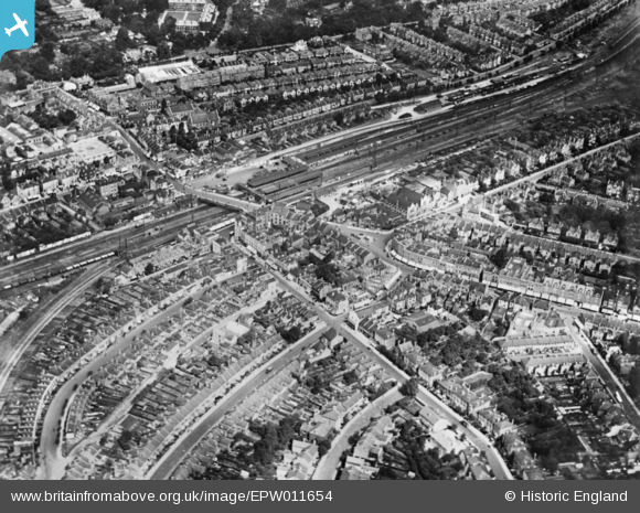
EPW011654 ENGLAND (1924). The railway station and environs, Wimbledon, 1924. This image has been produced from a copy-negative.
© Copyright OpenStreetMap contributors and licensed by the OpenStreetMap Foundation. 2026. Cartography is licensed as CC BY-SA.
Nearby Images (10)
EPW011654

EPW057031

EPW011653

EPW057027

EPW057029A
, Wimbledon, 1938. This image has been produced from a copy-negative.")
EPW057029

EPW057029B
, Wimbledon, 1938. This image was modified by the Aerofilms Ltd Artists' Department and has been produced from a copy-negative.")
EPW010723

EPW057030

EPW057026

Details
| Title | [EPW011654] The railway station and environs, Wimbledon, 1924. This image has been produced from a copy-negative. |
| Reference | EPW011654 |
| Date | August-1924 |
| Link | |
| Place name | WIMBLEDON |
| Parish | |
| District | |
| Country | ENGLAND |
| Easting / Northing | 524868, 170561 |
| Longitude / Latitude | -0.20399217989183, 51.41979842918 |
| National Grid Reference | TQ249706 |
Pins
 |

Class31 |
Wednesday 12th of November 2014 11:21:42 AM |