
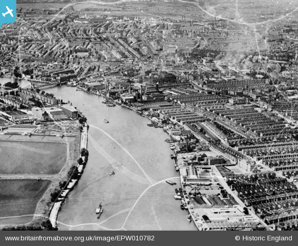
EPW010782 ENGLAND (1924). A cityscape over Hammersmith and the River Thames, Hammersmith, 1924. This image has been produced from a damaged copy-negative.
© Copyright OpenStreetMap contributors and licensed by the OpenStreetMap Foundation. 2026. Cartography is licensed as CC BY-SA.
Nearby Images (20)
EPW010782

EPW024773

EPW024774

EPW022804

EPW022803

EPW024775

EPW022800

EPW022802

EPW022799

EPW022560

EPW059342

EPW022555

EPW022801

EPW022805

EPW022554

EPW022556

EPW022558

EPW022561

EPW007981

EPW022557

Details
| Title | [EPW010782] A cityscape over Hammersmith and the River Thames, Hammersmith, 1924. This image has been produced from a damaged copy-negative. |
| Reference | EPW010782 |
| Date | June-1924 |
| Link | |
| Place name | HAMMERSMITH |
| Parish | |
| District | |
| Country | ENGLAND |
| Easting / Northing | 523343, 177663 |
| Longitude / Latitude | -0.22343859692832, 51.483966995732 |
| National Grid Reference | TQ233777 |
Pins

Des Elmes |
Thursday 14th of April 2016 01:14:07 PM | |
|
Des Elmes |
Thursday 14th of April 2016 01:11:47 PM | |
|
Des Elmes |
Thursday 14th of April 2016 01:09:23 PM | |

Alan McFaden |
Thursday 23rd of October 2014 11:17:01 AM | |

designking |
Sunday 28th of September 2014 09:40:40 PM |
