
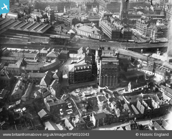
EPW010343 ENGLAND (1924). R. Robinsons and Company Works (Turnball Warehouse) and environs, Newcastle upon Tyne, 1924. This image has been produced from a print.
© Copyright OpenStreetMap contributors and licensed by the OpenStreetMap Foundation. 2026. Cartography is licensed as CC BY-SA.
Nearby Images (17)
EPW010343
 and environs, Newcastle upon Tyne, 1924. This image has been produced from a print.")
EPW010395
 and the surrounding city, Newcastle upon Tyne, 1924. This image has been produced from a print.")
EPW010345
, Newcastle upon Tyne, 1924")
EPW010392

EPW010344
, Newcastle upon Tyne, 1924")
EPW009980
, Newcastle upon Tyne, 1924")
EPW010342

EPW010341
 and environs, Newcastle upon Tyne, 1924")
EPW010411

EPW009979

EPW009976

EPW009975

EPW009978

EPW009977

EPW048800

EPW010393

EAW405203

Details
| Title | [EPW010343] R. Robinsons and Company Works (Turnball Warehouse) and environs, Newcastle upon Tyne, 1924. This image has been produced from a print. |
| Reference | EPW010343 |
| Date | April-1924 |
| Link | |
| Place name | NEWCASTLE UPON TYNE |
| Parish | |
| District | |
| Country | ENGLAND |
| Easting / Northing | 424941, 563772 |
| Longitude / Latitude | -1.6103777247865, 54.967870130783 |
| National Grid Reference | NZ249638 |
Pins
Be the first to add a comment to this image!