
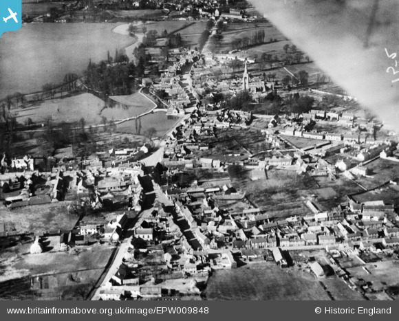
EPW009848 ENGLAND (1924). The town, Godmanchester, 1924. This image has been produced from a print.
© Copyright OpenStreetMap contributors and licensed by the OpenStreetMap Foundation. 2026. Cartography is licensed as CC BY-SA.
Nearby Images (3)
EPW009848

EAW051772

EAW051773

Details
| Title | [EPW009848] The town, Godmanchester, 1924. This image has been produced from a print. |
| Reference | EPW009848 |
| Date | March-1924 |
| Link | |
| Place name | GODMANCHESTER |
| Parish | GODMANCHESTER |
| District | |
| Country | ENGLAND |
| Easting / Northing | 524540, 270428 |
| Longitude / Latitude | -0.17268019742591, 52.317420792257 |
| National Grid Reference | TL245704 |
Pins

NickA |
Friday 20th of September 2019 01:54:54 PM |