
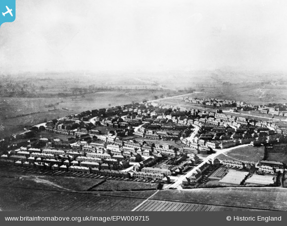
EPW009715 ENGLAND (1923). The Becontree Estate around Bennett's Castle Lane and Lindisfarne Road, Becontree, from the north-east, 1923. This image has been produced from a copy-negative.
© Copyright OpenStreetMap contributors and licensed by the OpenStreetMap Foundation. 2026. Cartography is licensed as CC BY-SA.
Nearby Images (4)
EPW009715

EPW024283

EPW009713

EPW009714

Details
| Title | [EPW009715] The Becontree Estate around Bennett's Castle Lane and Lindisfarne Road, Becontree, from the north-east, 1923. This image has been produced from a copy-negative. |
| Reference | EPW009715 |
| Date | 1923 |
| Link | |
| Place name | BECONTREE |
| Parish | |
| District | |
| Country | ENGLAND |
| Easting / Northing | 547638, 186156 |
| Longitude / Latitude | 0.12981285239506, 51.554466758175 |
| National Grid Reference | TQ476862 |
Pins
Be the first to add a comment to this image!