
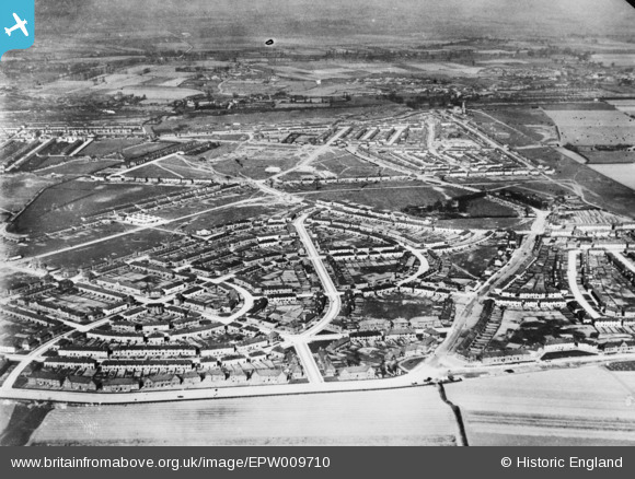
EPW009710 ENGLAND (1923). The Becontree Estate around Campden Crescent, Becontree, 1923. This image has been produced from a copy-negative.
© Copyright OpenStreetMap contributors and licensed by the OpenStreetMap Foundation. 2026. Cartography is licensed as CC BY-SA.
Nearby Images (3)
EPW009710

EPW024284

EPW024285

Details
| Title | [EPW009710] The Becontree Estate around Campden Crescent, Becontree, 1923. This image has been produced from a copy-negative. |
| Reference | EPW009710 |
| Date | 1923 |
| Link | |
| Place name | BECONTREE |
| Parish | |
| District | |
| Country | ENGLAND |
| Easting / Northing | 547272, 186252 |
| Longitude / Latitude | 0.12457708818646, 51.555425114635 |
| National Grid Reference | TQ473863 |
