
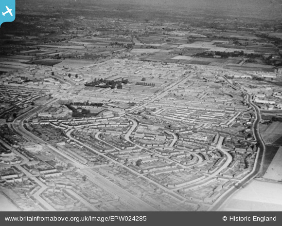
EPW024285 ENGLAND (1928). The Becontree Estate, Becontree, from the west, 1928. This image has been produced from a copy-negative.
© Copyright OpenStreetMap contributors and licensed by the OpenStreetMap Foundation. 2026. Cartography is licensed as CC BY-SA.
Nearby Images (5)
EPW024285

EPW024286

EPW009711

EPW009712

EPW009710

Details
| Title | [EPW024285] The Becontree Estate, Becontree, from the west, 1928. This image has been produced from a copy-negative. |
| Reference | EPW024285 |
| Date | September-1928 |
| Link | |
| Place name | BECONTREE |
| Parish | |
| District | |
| Country | ENGLAND |
| Easting / Northing | 547040, 186044 |
| Longitude / Latitude | 0.12114569819242, 51.553616500926 |
| National Grid Reference | TQ470860 |
Pins
Be the first to add a comment to this image!