
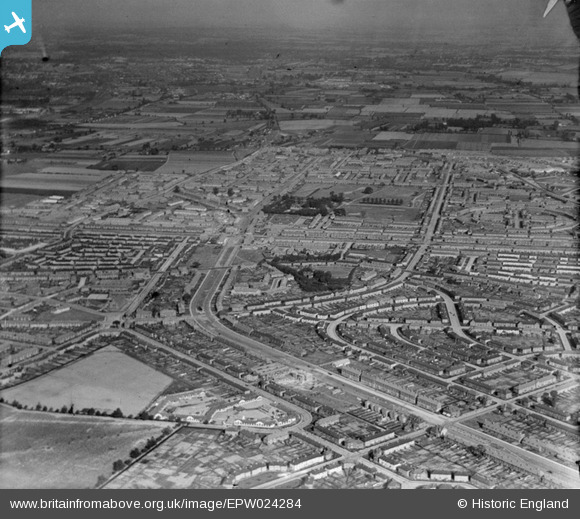
EPW024284 ENGLAND (1928). Housing surrounding Becontree Avenue, Becontree, from the west, 1928
© Copyright OpenStreetMap contributors and licensed by the OpenStreetMap Foundation. 2026. Cartography is licensed as CC BY-SA.
Nearby Images (2)
EPW024284

EPW009710

Details
| Title | [EPW024284] Housing surrounding Becontree Avenue, Becontree, from the west, 1928 |
| Reference | EPW024284 |
| Date | September-1928 |
| Link | |
| Place name | BECONTREE |
| Parish | |
| District | |
| Country | ENGLAND |
| Easting / Northing | 547104, 186299 |
| Longitude / Latitude | 0.12217493846991, 51.555891307971 |
| National Grid Reference | TQ471863 |
Pins

Dank |
Tuesday 16th of March 2021 04:53:03 PM | |
|
Dank |
Tuesday 16th of March 2021 04:49:05 PM | |
|
Dank |
Tuesday 16th of March 2021 04:48:37 PM | |
|
Dank |
Tuesday 16th of March 2021 04:47:51 PM | |
|
Dank |
Tuesday 16th of March 2021 04:40:32 PM | |
|
mardell8 |
Monday 28th of October 2013 05:42:33 PM | |
|
mardell8 |
Monday 28th of October 2013 05:36:41 PM | |
|
windblown |
Saturday 16th of February 2013 09:45:08 AM |