
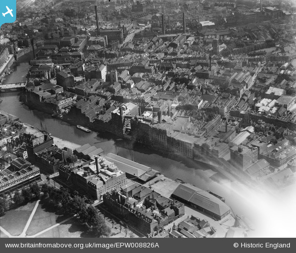
EPW008826A ENGLAND (1923). Redcliffe Wharf, Bristol, 1923
© Copyright OpenStreetMap contributors and licensed by the OpenStreetMap Foundation. 2026. Cartography is licensed as CC BY-SA.
Nearby Images (22)
EPW008826A

EPW008819

EPW008820

EPW008822

EPW008825

EPW008823

EPW008826

EPW008821

EPW008824

EAW026795

EAW032261

EAW032260

EAW032255

EAW000738

EAW032258

EAW032254

EAW032257

EAW032259

EPR000085

EAW032256

EAW000739

EAW026794

Details
| Title | [EPW008826A] Redcliffe Wharf, Bristol, 1923 |
| Reference | EPW008826A |
| Date | 1923 |
| Link | |
| Place name | BRISTOL |
| Parish | |
| District | |
| Country | ENGLAND |
| Easting / Northing | 359004, 172601 |
| Longitude / Latitude | -2.5900310486957, 51.450418695997 |
| National Grid Reference | ST590726 |
