
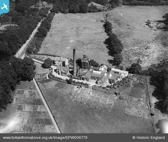
EPW006779 ENGLAND (1921). Laundry near the St Joseph's R.C. Convent Schools, Hendon, 1921
© Copyright OpenStreetMap contributors and licensed by the OpenStreetMap Foundation. 2026. Cartography is licensed as CC BY-SA.
Nearby Images (12)
EPW006779

EPW032976

EPW032974

EPW032972

EPW032978

EPW032979

EPW032977

EPW032973

EAW020704

EPR000512

EPW031657

EPW032975

Details
| Title | [EPW006779] Laundry near the St Joseph's R.C. Convent Schools, Hendon, 1921 |
| Reference | EPW006779 |
| Date | June-1921 |
| Link | |
| Place name | HENDON |
| Parish | |
| District | |
| Country | ENGLAND |
| Easting / Northing | 522350, 189012 |
| Longitude / Latitude | -0.23378915935819, 51.586189652715 |
| National Grid Reference | TQ224890 |
Pins
User Comment Contributions
The lane on the top left of this photo is now the Watford Way, Hendon, looking up the hill towards the Burroghs. I think the building at the very top of the picture, on the left would be in the grounds of the present day St Josephs School |

JC |
Friday 20th of July 2012 12:17:31 PM |