
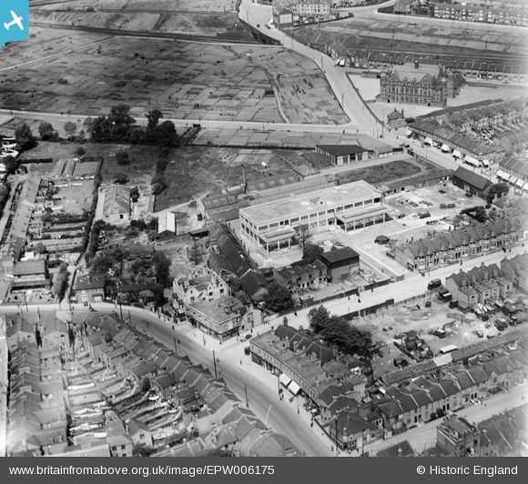
EPW006175 ENGLAND (1921). Colin Road and environs, Willesden, 1921
© Copyright OpenStreetMap contributors and licensed by the OpenStreetMap Foundation. 2026. Cartography is licensed as CC BY-SA.
Nearby Images (3)
EPW006175

EPR000521

EPW006174

Details
| Title | [EPW006175] Colin Road and environs, Willesden, 1921 |
| Reference | EPW006175 |
| Date | April-1921 |
| Link | |
| Place name | WILLESDEN |
| Parish | |
| District | |
| Country | ENGLAND |
| Easting / Northing | 521990, 184895 |
| Longitude / Latitude | -0.24041285028732, 51.549263482682 |
| National Grid Reference | TQ220849 |
